Wednesday, June 28, 2017

Hiking in Ireland: Beginning the Kerry Way, Days 1 and 2

28 June 2017

Aloha all!


Killarney to Black Valley, Ireland:  Statistics:  17.8 Miles or 40128 Caroline steps


Finally able to send an update on hiking the KerryWay -- Internet in many of the small villages where we have stayed is "iffy" or non-existent!


Saturday, June 23 we had a day of rest in Tralee, Ireland.  We said Aloha to our hiking pal Brian, who left for London to see friends.  We are now the "Three Amigos"... Pat, Kerri and Caroline.


We wandered Tralee on Saturday - checked out open markets, I went to church, and then had an Irish song and dance evening.  No photos at the song and 

dance night!
 Open market foods / vendors


 Below, a lovely Oak tree in the Tralee Community Garden /Park.
 Below- The interior of St. John's Church.  Stayed for Saturday night mass.


 The holy water fonts are a pair of angels... see one of the Angels below.
 Below- the exterior.  Skinny spire / bell tower.

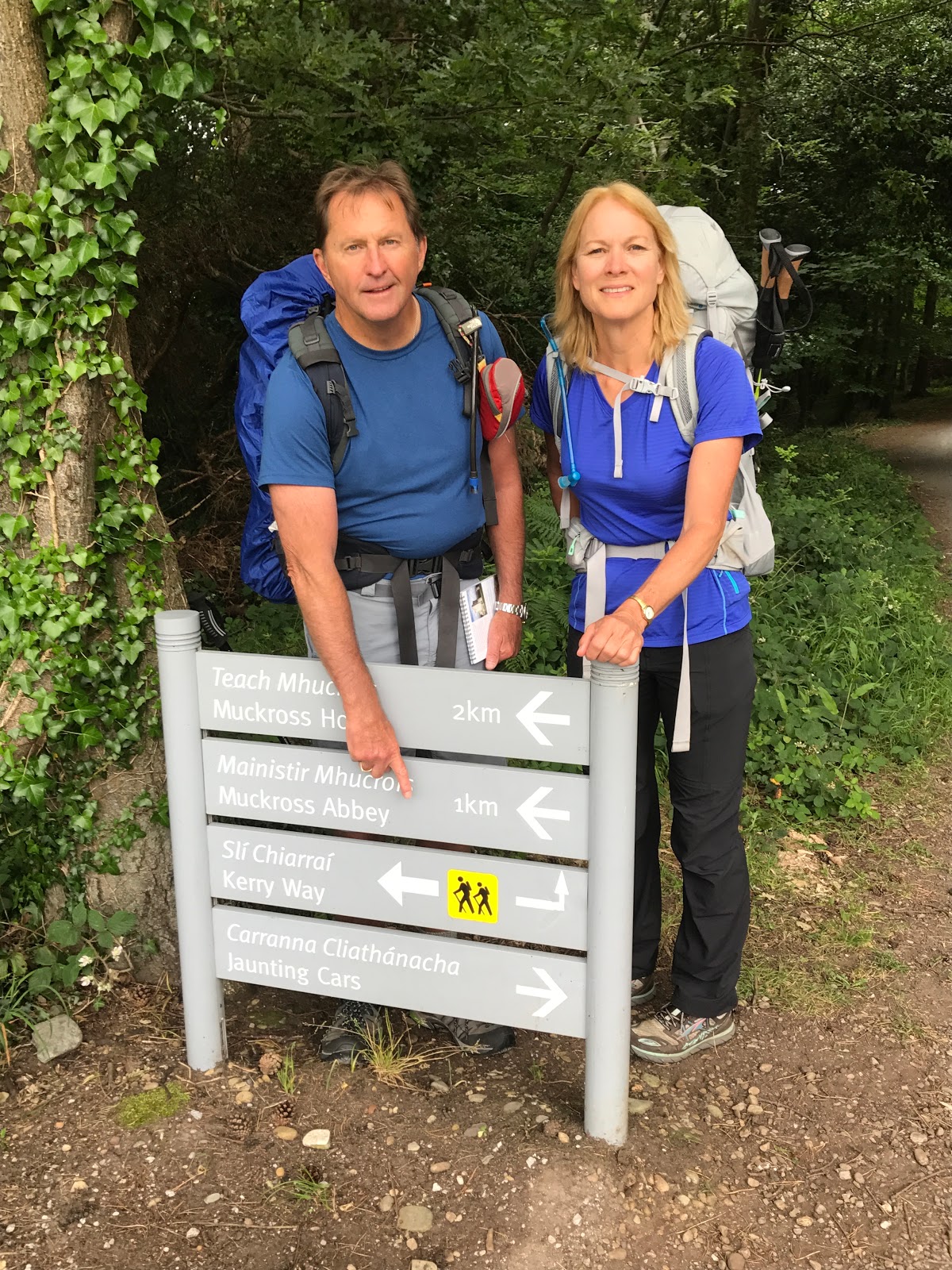
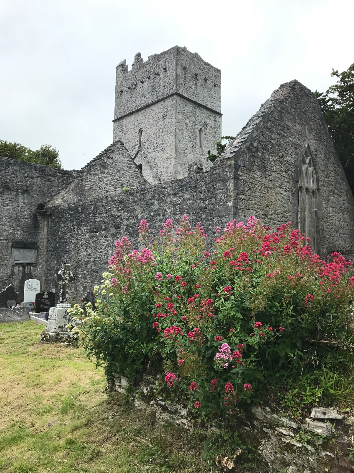
Sunday 24 June, we left the hostel early to catch the 8 a.m. Bus for Killarney, only to discover the bus schedule is different on Sunday.  We took a cab to Killarney and at 8"30 a.m. We began hiking the Kerry way- a long walk around the Ring of Kerry.   First stop on the Walk, The abbey at Muckross and then Muckross house and gardens.


 Above- Pat and Kerri pointing the way to start!
The path through the national park, which has Muckross House and the old Franciscan Abbey.


Looking to Muckross House. (Below)


From the lovely grounds of Muckross House, we walked to Torc waterfalls- part of the Killarney National Forest. And then from there we took the old Kenmar road/path through the park and onto the Irish Moors.
 Above - the Torc Waterfall.  Below, the view as we climbed above the water falls.
Below, leaving the trees and walking towards the Moors. 
Below - the old Kenmar road through the park.  Foxglove is a wildflower here on hills and fields.  
 Above, Kerri en route
 Foxglove everywhere.
 A very pretty waterfall in the middle of the moors.  Not too many people here.  Just the three amigos walking along.  

Below:  Wood trestles with wire mesh across.  These trestles are everywhere as we walk across the bogs and wet open fields.

 Views below of the path, rock walls and a church along the way.  


 Walking across very open, very wet meadow lands.

 Leaving the hills and coming into "civilization"- a cafe for a much needed break.  We had walked 14 miles to this point! And we still had more to go to reach our B&B.  
Below:  Our B & B... 4 KM outside town- lovely and luckily on the path for Day 2! 


LONG day and our B& B was a welcome sight!  Simple but nice place.

Day 2:  Black Valley to Glencar

Statistics:  Only 12 miles or 12,700 Caroline Steps.  BUT 127 Stories!

This was a real hiking day.  We climbed about 1000 feet - rocks and narrow paths, slippery because of the water/ rain from the night before.  We climbed the equivalent of 127 floors in a sky scraper.  And we ssaw only ONE other person!


Below: Looking at hill #1 we were about to climb and then descend onto the other side!


The path/old road.
Scenery above and below


Taking a break on some soft rocks.
Panoramas of the scenery and the hike... Above a way maker pole showing the path down!
A panorama of the view down and looking at Hill #2
Another Soft Rock break (above) as we climb #2
Scenery above and below.  Crossing from Black Valley to the Birdie Valley!s
Above- what we climbed down. Destination B & B

Hopefully clicking on the pictures will give you a bigger picture!  Weather has been cloudy and cool... perfect for hiking, especially with all the hills and no shade cover from big trees.

Days 3 and 4 will some shortly.

Aloha and mahalo for reading about the adventure!


No comments:

Post a Comment